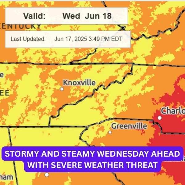
INDIANAPOLIS (WISH) — Keep your guard up on Wednesday as strong to severe storms are on the radar.
Tuesday Night:
Related posts

Scattered showers and storms could roll in through early Wednesday, mainly from a system approaching from the west.
Wednesday:
Stay weather-aware—Wednesday is shaping up to be quite active. Some showers and storms may pop up in the morning, with more developing in the afternoon and continuing into the night.
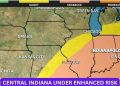
Storms later in the day bring the risk of severe weather. Most of central Indiana falls under an Enhanced Risk (level 3 of 5). Expect damaging winds and localized flooding to be the main concerns, though isolated tornadoes and hail can’t be ruled out.
Highs will climb to the mid-80s with oppressive humidity. Dew points will hover in the low to mid-70s, making it feel very sticky.
Thursday:
A few early showers and storms might linger into Thursday morning. It’ll be warm again, but the humidity should ease slightly—still uncomfortable, just not quite as intense. Highs in the low 80s.
7-Day Forecast:
Summer kicks off Friday with highs in the mid-80s, but then we head straight into our first heatwave of 2025. Indy hasn’t hit 90° yet this year, but that could change this weekend. Expect low 90s and heat index values that could hit triple digits. This heat wave may stretch into next week, possibly triggering heat alerts.


