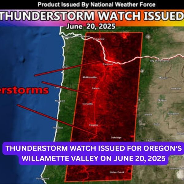
The National Weather Force has issued a Thunderstorm Watch effective Friday, June 20, 2025, from 11:00 a.m. to 8:00 p.m. for parts of the Pacific Northwest, including Oregon’s Willamette Valley and Southwest Washington.
Date Issued: June 19, 2025, at 5:20 p.m. PDT
Affected Areas:
Related posts


-
Oregon: Western region, primarily along and near the Willamette Valley
-
Washington: Southwest
Forecast Details
A rare summer storm system is expected to move through the region, with its center tracking from Seattle into Eastern Washington throughout the day. Forecasters say strong mid- to upper-level winds will create significant atmospheric lift, especially south of the system’s center — setting the stage for thunderstorm development.
Storm tops could reach up to 20,000 feet, and with freezing levels near 5,000 feet, there’s enough vertical depth in the atmosphere to support cloud electrification and lightning activity.
Expected Hazards
-
Lightning
-
Small hail
-
Gusty winds
-
Localized flooding
Thunderstorm Watches are rarely issued for West Coast regions, but when conditions like these emerge, the National Weather Force takes action. These watches are not issued for areas east of the Rockies, where thunderstorms are more frequent.
Residents and travelers in the affected areas should stay alert and monitor weather updates throughout the day.


